San Diego Real Estate Drone Photography: FAA Rules, Restricted Airspace, and What Agents Need to Know
Drone shots have moved from a nice-to-have to an expected part of any serious San Diego listing. Buyers coming from out of state want to see the lot line, the pool orientation, the ocean peek, the distance to the trailhead. A single aerial frame answers questions ten ground photos cannot.
But drone photography for real estate is also one of the most regulated kinds of commercial photography in the country, and San Diego’s airspace is among the most restricted on the West Coast. If a listing agent hires an uninsured hobbyist to fly over a client’s home, the agent — not just the pilot — can end up on the wrong side of FAA enforcement and the brokerage’s E&O policy.
This guide covers what every San Diego listing agent should know before booking drone work: the FAA rules that apply, the airspace restrictions specific to this county, what commercial drone photography actually costs, and the questions to ask any provider before they fly over your client’s property.
Is a drone license required for real estate photography?
Yes. Any drone flight done for a commercial purpose — including photographing a home that will be listed for sale — requires the pilot to hold an active FAA Part 107 Remote Pilot Certificate. This has been the rule in the United States since August 2016.
Posting the photos on the MLS, on Zillow, in a brochure, or on a brokerage website all count as commercial use. A friend with a DJI who “just helps out” is not a loophole; the FAA has issued fines in the five figures for commercial flights by uncertified pilots, and it does act on complaints from neighbors.
At YonoPro every drone flight is operated by a Part 107 certified pilot, and we carry commercial drone liability insurance that names the listing agent and brokerage as additional insured on request.
San Diego’s restricted airspace: what agents need to know
San Diego County contains some of the most densely controlled airspace in the country. A certified pilot can fly in most of it, but every flight requires airspace authorization through the FAA’s LAANC system (Low Altitude Authorization and Notification Capability), and some neighborhoods are no-fly without a case-by-case waiver that can take weeks.
The main constraints a San Diego listing agent should know about:
- San Diego International (Lindbergh Field) Class B airspace covers downtown, Point Loma, Hillcrest, Mission Hills, Golden Hill, and much of Coronado and the bay. Flights here require LAANC approval and are often capped at 50 feet above ground level, which limits — but does not eliminate — what is possible.
- MCAS Miramar controls Class C airspace that reaches across Mira Mesa, Scripps Ranch, Tierrasanta, Kearny Mesa, Serra Mesa, and parts of La Jolla and University City. Standard LAANC authorizations usually come through within minutes but altitude caps vary by grid.
- NAS North Island and Naval Base Coronado make most of Coronado, Imperial Beach, and the Silver Strand restricted or no-fly without a specific waiver. Agents listing in Coronado should plan on exterior ground photography by default and treat drone work as a two-to-four-week lead item.
- McClellan–Palomar (Carlsbad) controls Class D airspace covering most of Carlsbad, Encinitas, and parts of Vista and San Marcos.
- Montgomery–Gibbs Executive adds Class D coverage over Kearny Mesa and Clairemont.
- Gillespie Field covers El Cajon, Santee, and parts of La Mesa and Lakeside.
- Brown Field and Tijuana International affect Otay Mesa and the South Bay border zone.
In practice this means two things. First, most listings in San Diego County touch controlled airspace somewhere, so working with a pilot who already knows the LAANC grid is faster than finding out at the shoot. Second, altitude caps are real: a listing with a sweeping ocean view may legally be shot at 50 feet instead of the FAA’s default 400 feet, which changes composition. A good drone operator plans the shot list around the ceiling.
Beyond the FAA: California and local rules
California state law adds a privacy layer on top of federal rules. Civil Code section 1708.8 makes it a civil offense to capture images of a person engaged in a private activity on their property, including with a drone, without consent. For listing photography this almost never comes up — the drone is over the subject property with the owner’s permission — but neighboring properties and backyards are part of the frame. Pilots should plan passes so adjacent homes are not the focal point.
Local rules add a third layer. The City of San Diego, Coronado, La Jolla, and most of the county’s parks and beaches prohibit drone takeoff and landing from public parks and beaches without a permit. Launching from the listing’s own driveway or yard is the standard workflow.
How much does drone photography cost in San Diego?
Aerial photography and drone video are typically add-ons to a full listing package rather than standalone shoots, because the drone operator is already on site. Pricing varies by provider, but the market in San Diego for 2026 runs roughly:
- Aerial photo add-on: $150 to $400 as part of a full package; $300 to $600 standalone.
- Drone video add-on: $200 to $600 depending on length and editing; $400 to $900 standalone.
- Twilight aerial (shot in the 20 minutes after sunset): $200 to $500 add-on.
- LAANC waiver work for restricted airspace (Coronado, downtown rooftops over 50 ft): sometimes a flat $150 to $300 surcharge, sometimes included.
At YonoPro, aerial photography starts at $350 as an add-on and drone video at $550 as an add-on. Both are included in the Full Package for most property sizes. See the pricing page for current rates.
What shots actually sell a San Diego listing?
The temptation on a first drone shoot is to fly high and wide. For listing media that is usually the least useful frame. Three aerial shots that consistently earn clicks on the MLS and Zillow:
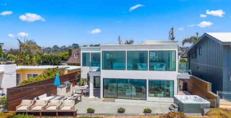
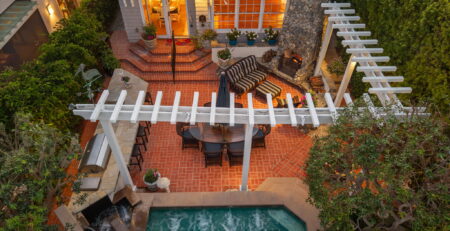
- The “lot line” shot at 120 to 180 feet, straight down or at a 60-degree angle, with the property outlined by its driveway, fence, or coastline. Answers the first question every out-of-state buyer asks: how big is the actual lot?
- The context shot at 200 to 300 feet, looking across the property toward the ocean, canyon, downtown skyline, or mountains. This is the one that explains why the home is worth what it is.
- The approach shot at 40 to 80 feet, flown in a slow forward motion from the street toward the front door, used as the opening clip of a listing video. The reveal of the house behind the gate or trees is the single highest-retention frame in short-form real estate video.
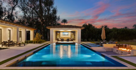
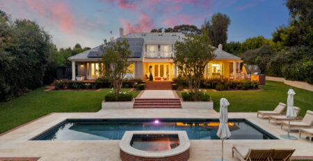
Twilight aerials of a lit pool or ocean-view home consistently out-perform daytime aerials on social; if the listing has either, book the twilight slot.
What to ask any drone provider before you book
Four questions separate professional operators from hobbyists:
- Can you send me a copy of your Part 107 Remote Pilot Certificate and your commercial drone insurance declarations page?
- Have you flown in this ZIP code before, and if the property is in controlled airspace, do you file LAANC yourself or ask the agent to?
- What is your workflow if the FAA grid caps the altitude lower than the property’s view line?
- Do you deliver aerials color-matched to the ground photography so the full gallery looks like one shoot?
A pilot who answers those four cleanly is one who will not create a problem later.
FAQ
Can my client fly their own drone and give me the photos?
Legally, no — if the home is being listed for sale, the photos are commercial use and the pilot needs a Part 107 certificate. The listing agent takes on real liability if the FAA follows up on a complaint.
How long does drone work add to a shoot?
For a standard San Diego home outside restricted airspace, add 20 to 40 minutes on site. In controlled airspace that requires same-day LAANC, add about an hour. Coronado and other waiver-only zones need to be booked one to four weeks ahead.
Can you fly on windy or overcast days?
Most prosumer drones are rated to about 20 to 24 mph sustained wind. San Diego’s coastal afternoons regularly exceed that in winter and spring, which is one reason morning shoots deliver more usable aerial frames. Overcast is fine for photo and often preferred for even lighting; it is only a problem for twilight aerials, which need a clear western horizon.
What about HOAs and gated communities?
HOAs cannot override FAA airspace rules, but they can and do restrict launch and landing on common areas. Launching from the listing’s own property is almost always the cleanest answer. For high-density condo buildings, we coordinate with the HOA before the shoot.
Do I need the neighbor’s permission?
No, provided the drone stays over the subject property for the shot and does not focus on activity on neighboring parcels. Overflight of a neighbor is permitted under federal rules; the privacy concern is what the camera is pointed at, not where the drone is.
Ready to add drone work to your next listing?
YonoPro provides Part 107 licensed drone photography and video across San Diego County and Los Angeles County, color-matched to the ground gallery and delivered within 48 hours for video (12 hours for photos). Book a shoot or send us the listing address for a quote.